Two years ago, four of my friends and I attempted the Presidential Traverse: a formidable hike that links together eight peaks in the White Mountains of New Hampshire: Mounts Madison, Adams, Jefferson, Washington, Monroe, Eisenhower, and Pierce (and sometimes Jackson). The hike didn’t go well. We were thwarted by gastroenteritis, impenetrable fog, and a thunderstorm that forced us to bail halfway. I vowed to return.
Four years ago, Katie and her friends attempted to hike the 23-mile traverse in one day. It was her first hike (it’s kinda ambitious for a first hike, no matter how fit you are…) and she aborted 13 miles in at the summit. It did, however, spark her quite illustrious hiking streak, and she vowed to return as well.
So, last weekend, we drove up to tackle the traverse once more.
We set it up well: an extra day to drive up, lodging nearby, assistance with the car shuffle (we parked at the end and hitched a ride to the trailhead), and bunks for the night in a mountaintop hut, which let us pack much less gear. Mount Washington has America’s worst weather (cloud cover half the time, 200+ mph gusts), but we got luckywith perfect weather. Hardly any clouds and minimal wind (well… some wind). And the hike was STILL hard.
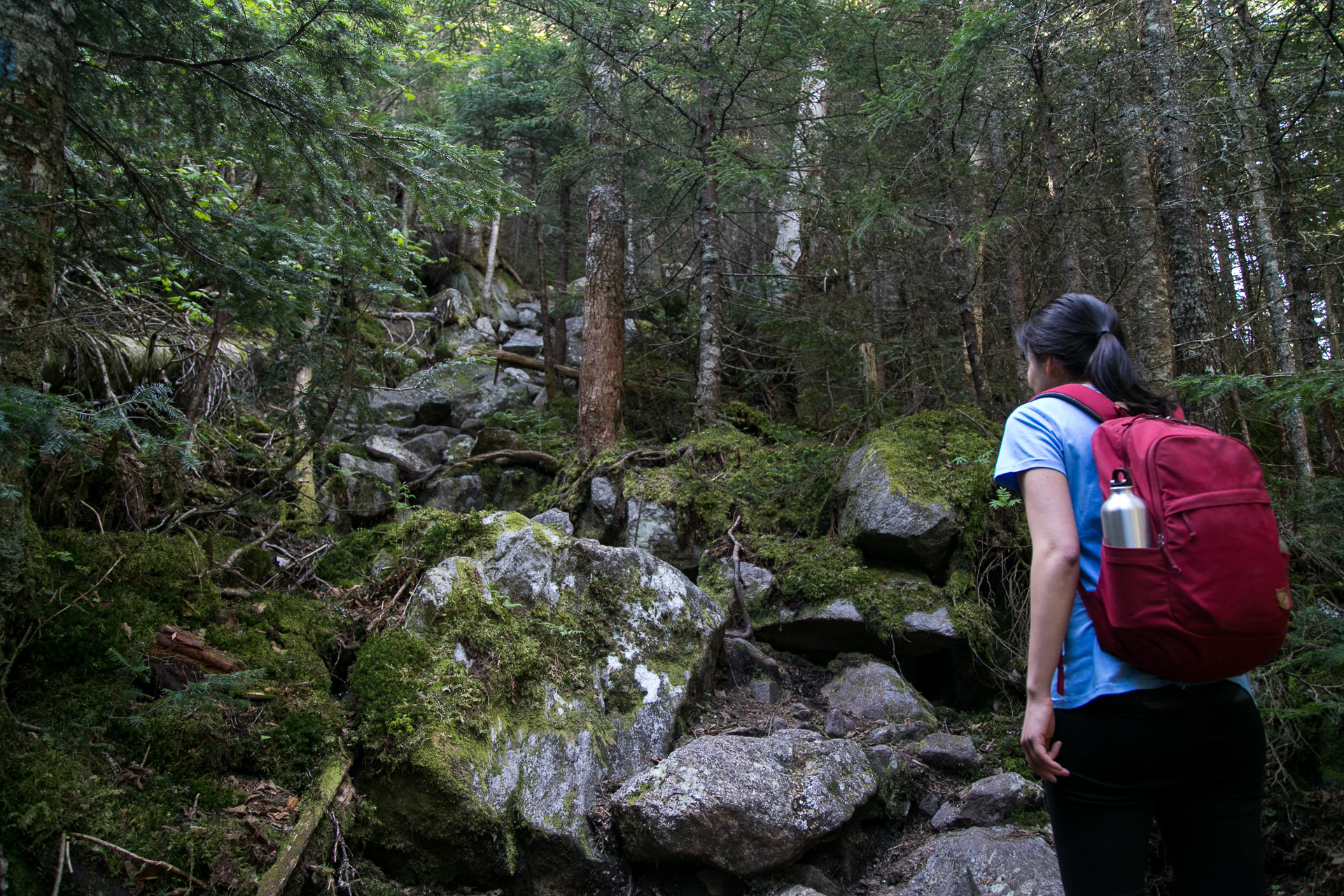
First up: climbing 4000 feet in elevation over 4 miles up the side of Mount Madison. That’s through the forest in the valley, past the tree line, and up the pile of boulders that constitutes the summit.

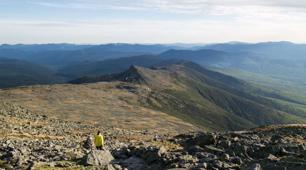
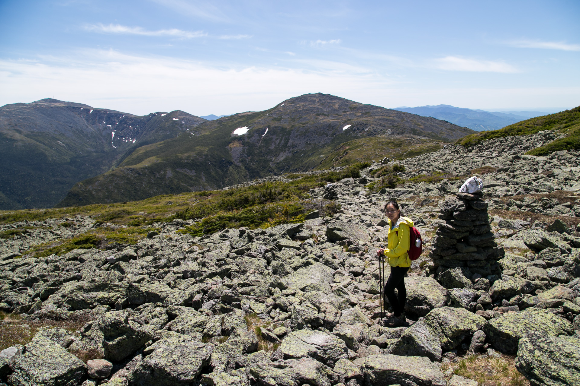
On that beautiful clear day, we could see the next peaks stretching out before us: Adams, Jefferson, and the tallest Washington. None of it was straightforward though, hiking up and down ridges through countless rock fields. 14 miles and 6000+ feet of climbing in one day…
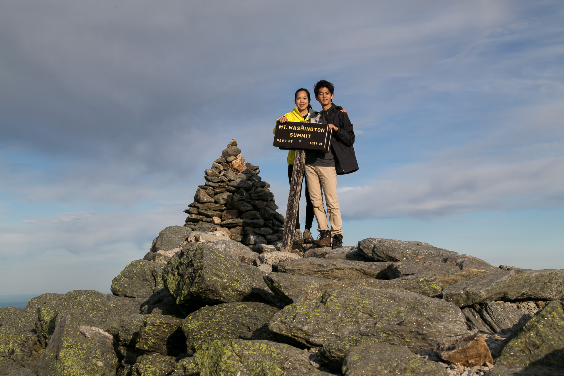
Our lodging for the night, the Lakes of the Clouds Hut at mile 13, always looked just out of reach. As soon as we turned the corner on Mount Washington, it looked 0.5 miles away, not the 1.8 miles like the sign indicated. After walking for half an hour more, the illusion persisted. Even when we branched off at a fork and hiked away from the hut to summit Mount Washington (highest point in the northeast!) the hut still looked just as close.
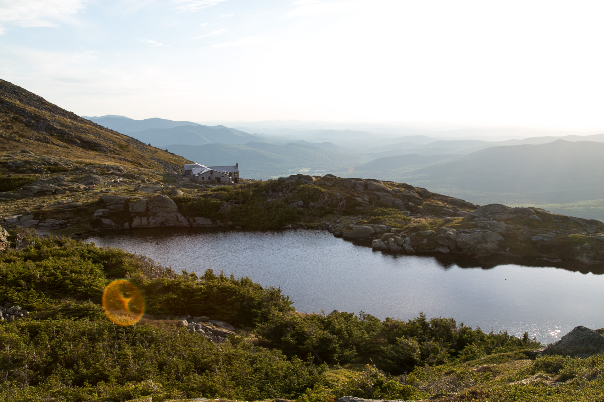
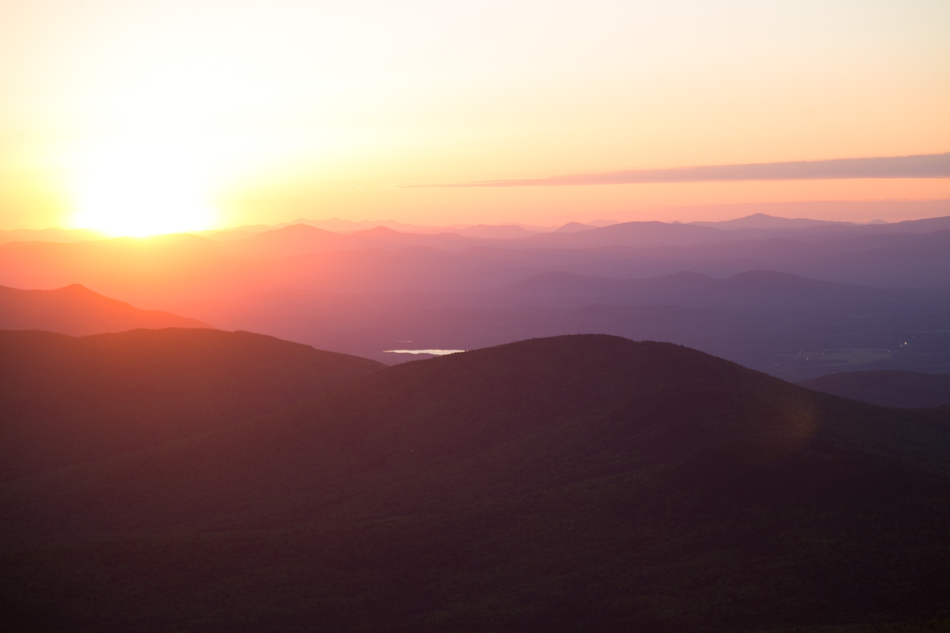
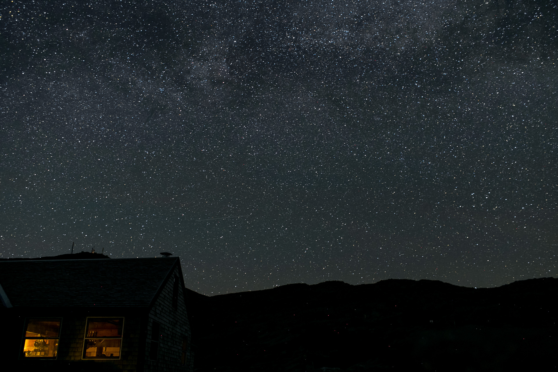
Alas, but reality strikes (and hurts) when we’re on the mountain, and I was too pooped to hike briskly to the hut. We were two hours late to the scheduled dinner (yeah they have dinner up there. wut) but they very kindly served us fresh food anyway (with table service. wut). But the best part: getting to watch the sun set behind the white mountains. Layers upon layers of mountains, I’ve never seen anything like it. Later, I walked out into the temperate night to see the Milky Way not obscured by light pollution nor foul weather.
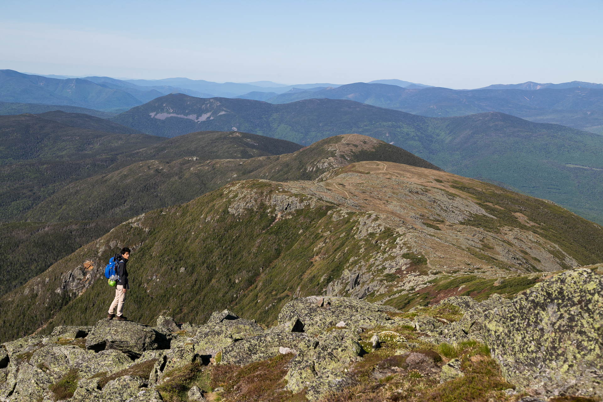
The second day was considerably easier: 9 miles of more forgiving trail and barely any upwards climbing. Starting from Mount Washington, the tallest point, we could see the subsequent peaks ahead, except instead of looming above they stretched out beyond.
Traverse traversed! Then came the 7 hour drive back to New York City. Next up, hopefully even more outdoor adventures.