14 days, 2050 miles of driving, 6 national parks in southern Utah and northern Arizona, and a few extra attractions. Prepare yourselves.
Prologue: Las Vegas, Valley of Fire
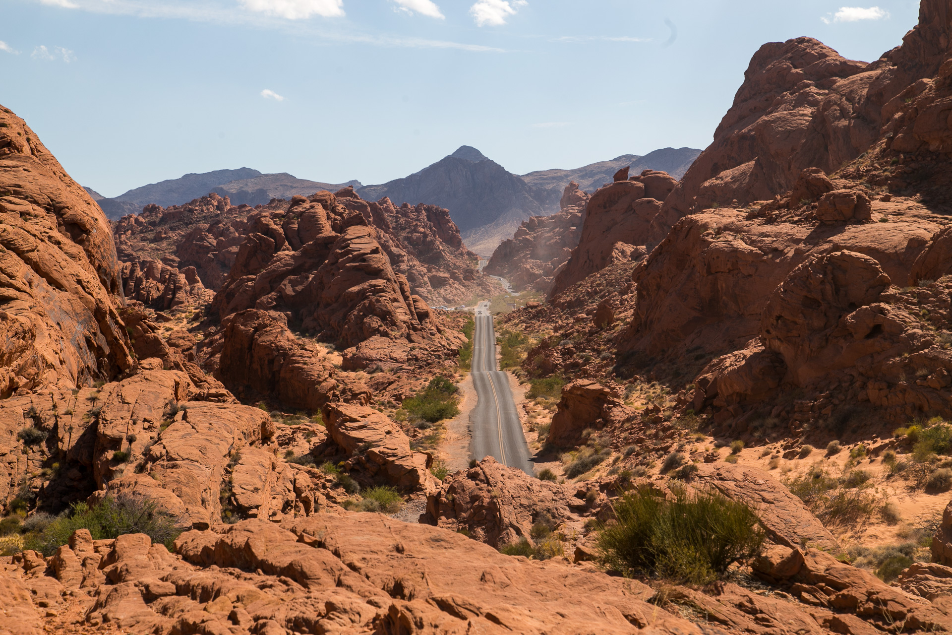
After flying into Las Vegas airport, we drove straight for the main attractions for us in the city: Trader Joe’s and REI! After stocking up, we drove east to immediately to Nevada’s Valley of Fire State Park.
The park is like an anti-oasis, with vivid red sandstone randomly arising from underneath much more ordinarily-colored sedimentary rock. In the middle of the park is this fantastic straight road winding up and down through a spectacular canyon.
Chapter 1: Zion
We camped for three nights right underneath the epic Watchman mountain that welcomes visitors right when they enter the park from the south.
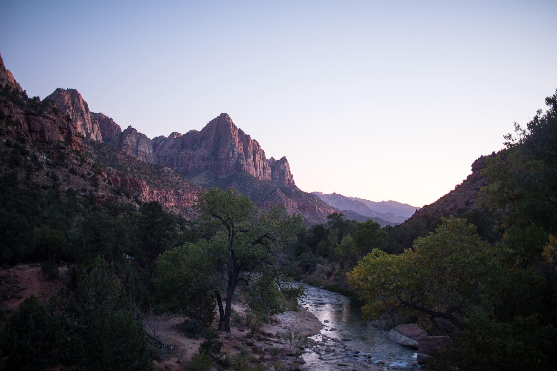
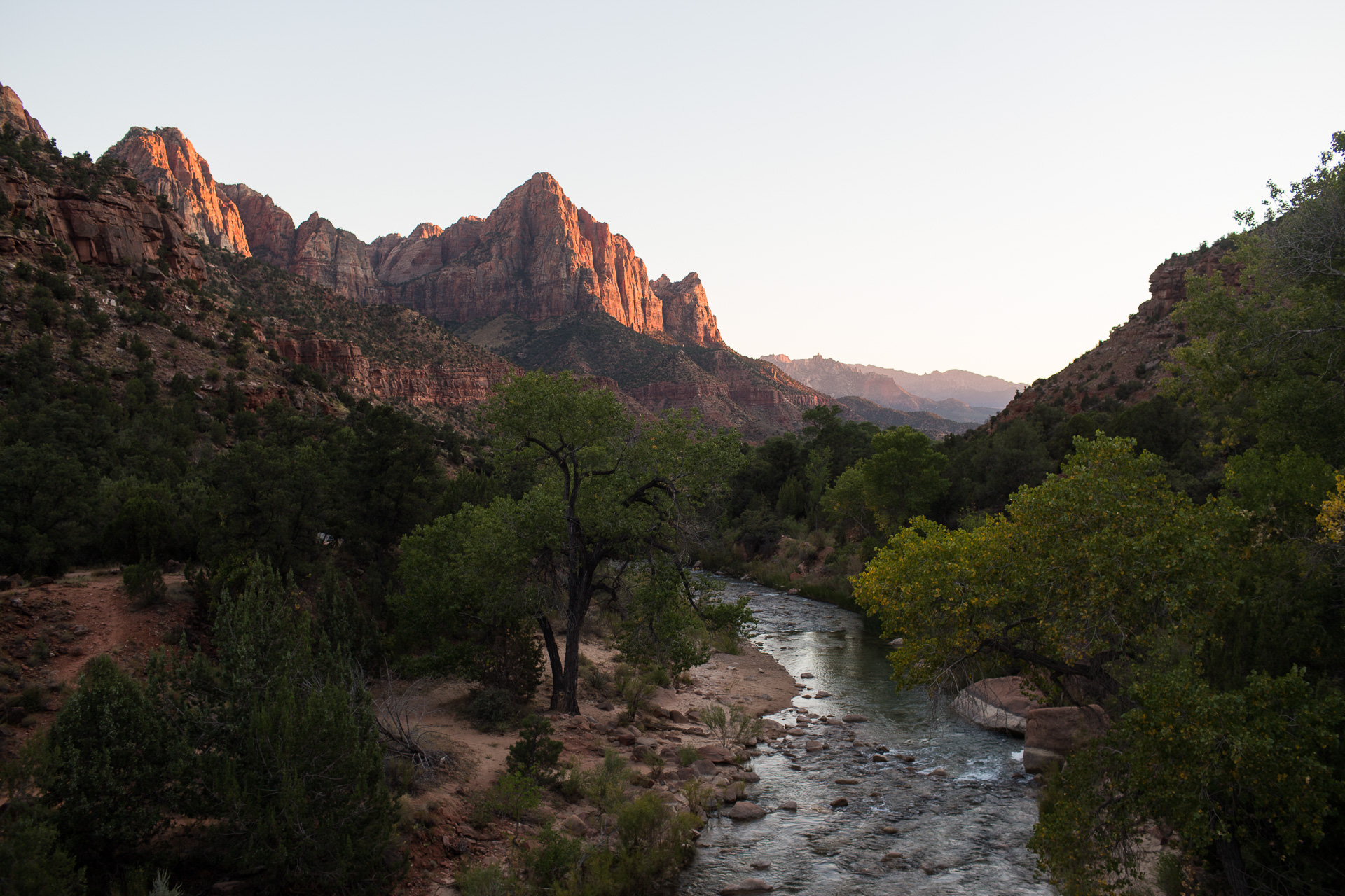
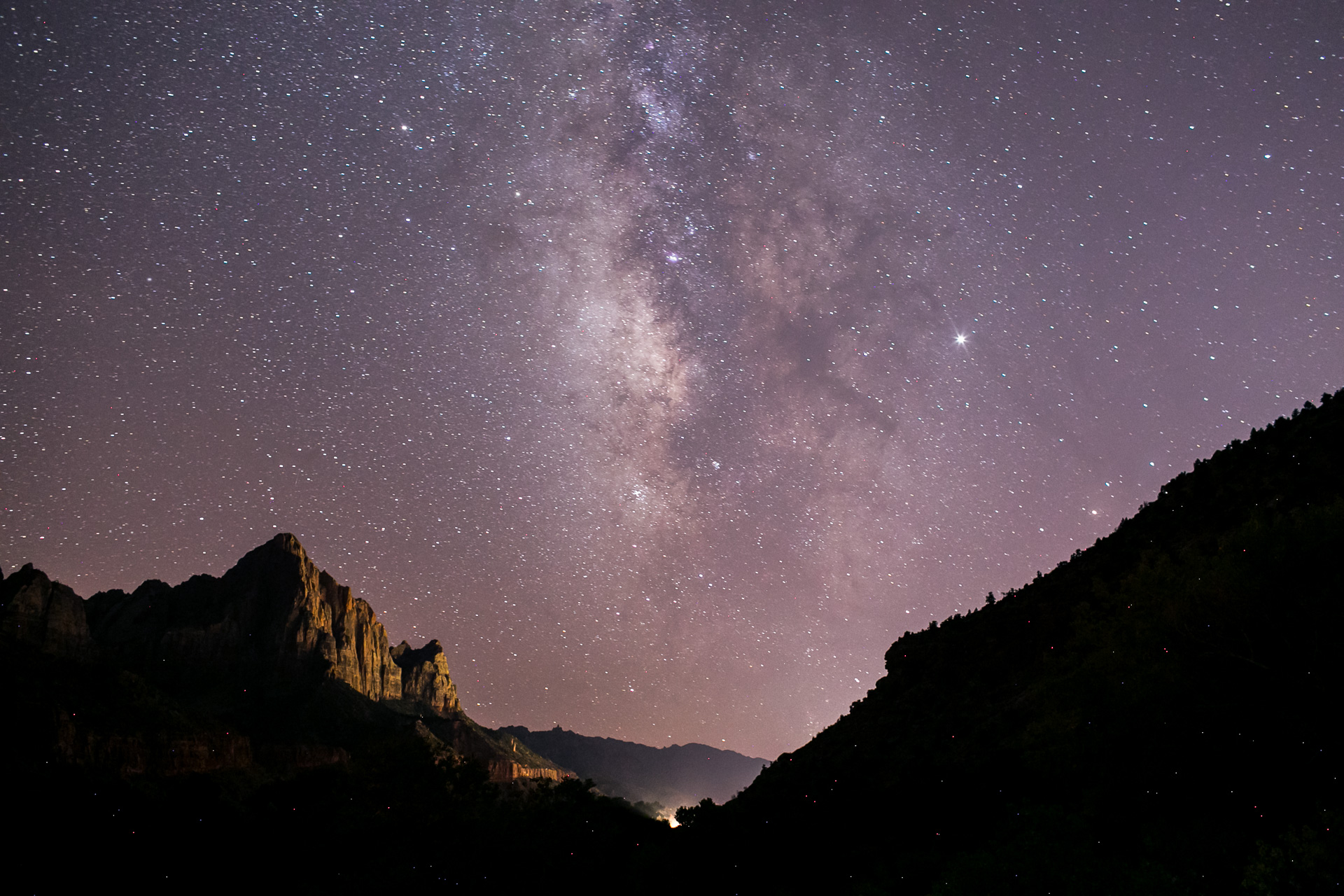
That humble stream in the foreground is actually the mighty Virgin River which is responsible for carving out all of Zion. Yes, even the awe-inspiring main canyon with walls up to 2000 feet high, all of that is thanks to the erosive power of sediment-laden floodwater.
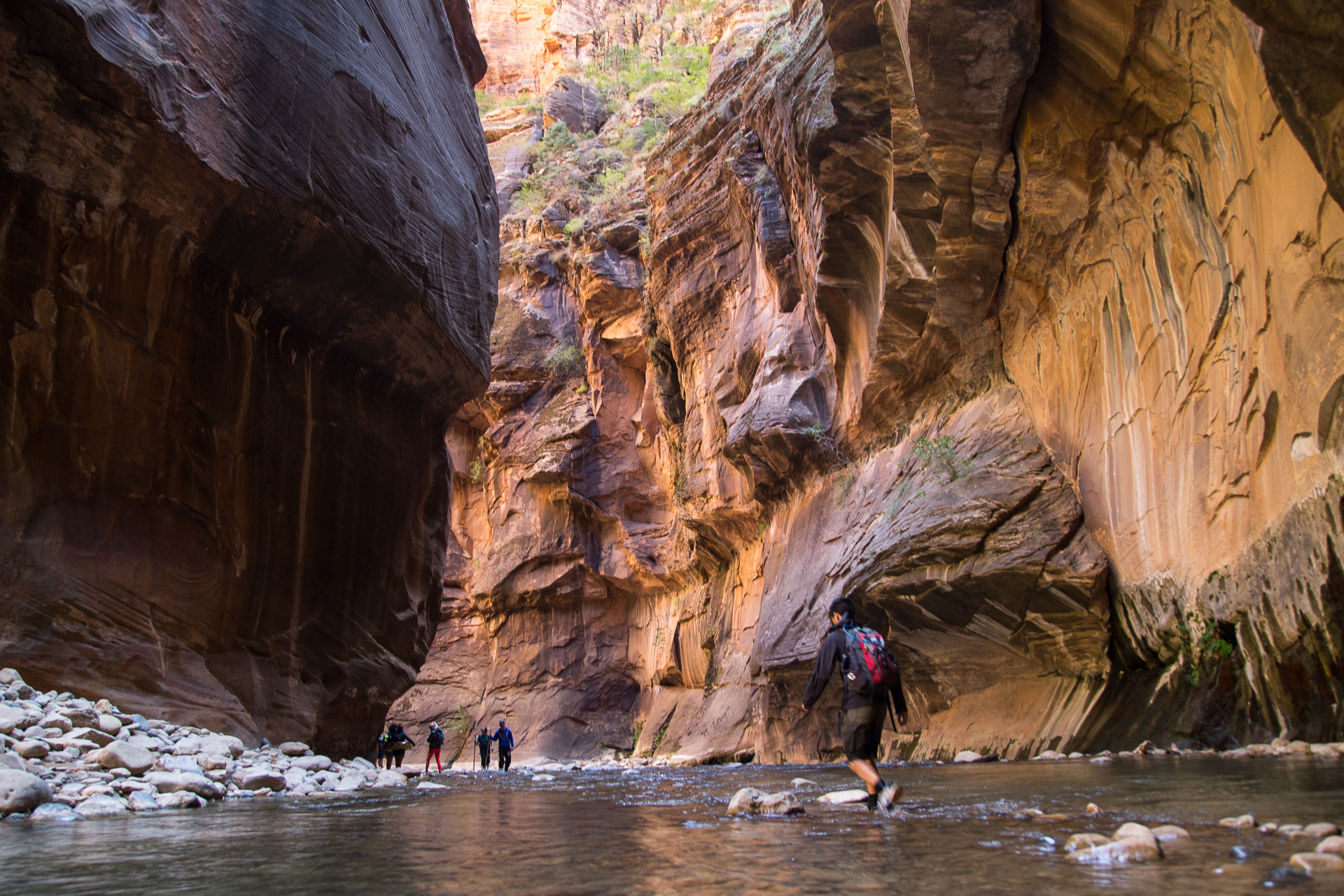
Then there’s the Narrows, perhaps the most unique hike in all of the United States. Where else can you wade through ankle- to waist-deep water up a giant slot canyon that’s a straight 1000 vertical feet high? That’s right, nowhere else.
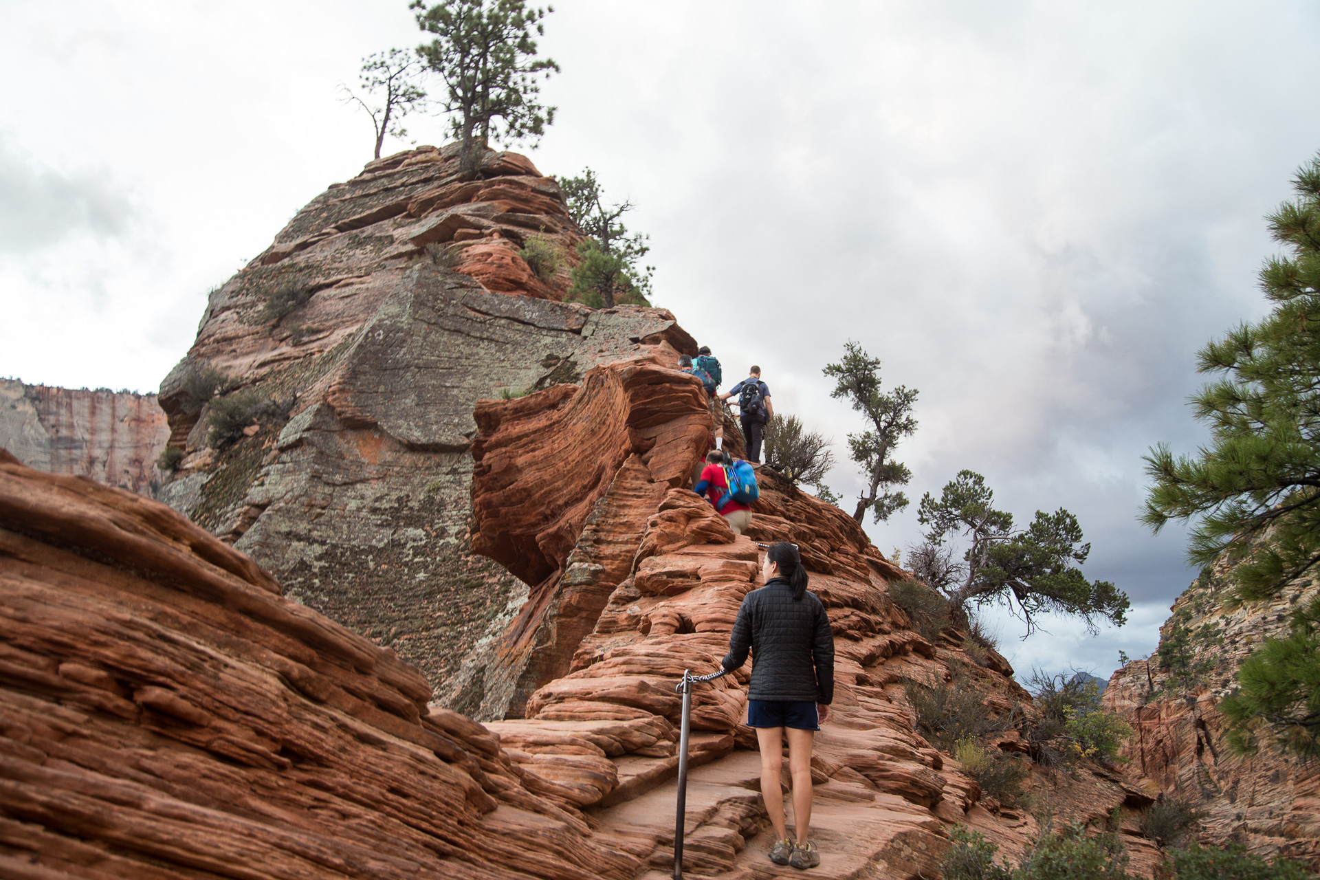
Zion’s beauty attracts a mind-boggling number of visitors each year, so much that most of time only the shuttles are allowed to drive in the main canyon. There’s still plenty outside of those boundaries, such as the Observation Point hike (not pictured in this collection) and Echo Canyon on the back side of the main canyon.
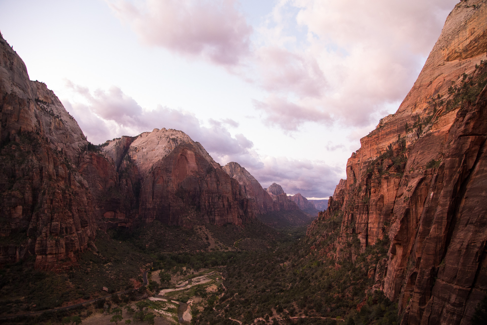
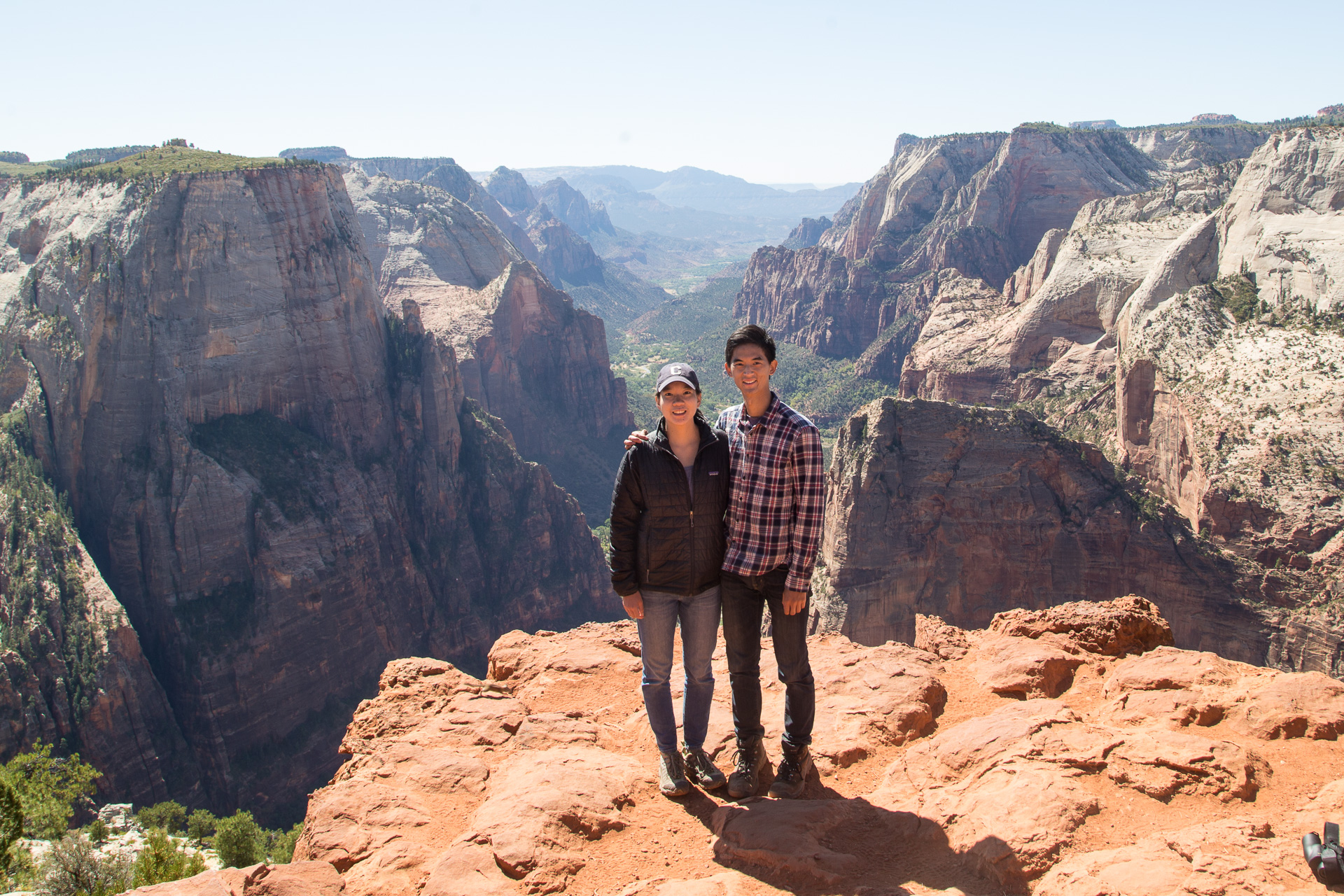
We didn’t realize that a landslide recently wiped out a trail section next to Weeping Rock, which is the usual access point to the high vantage called Inspiration Point, so we decided to drive an hour outside of the park and hike to it from behind. It was strenuous but certainly worth it.
Chapter 2: Grand Canyon, North Rim
We only witnessed the grandest of Canyons from the North Rim, not the more popular and arguably more scenic South Rim. It couldn’t be helped, as the focus of the itinerary was the Utah section, and the rims are separated by a four-hour drive. Still, the North Rim is at 8000′ elevation, 1500′ higher than the South Rim, quieter, and a little wilder.
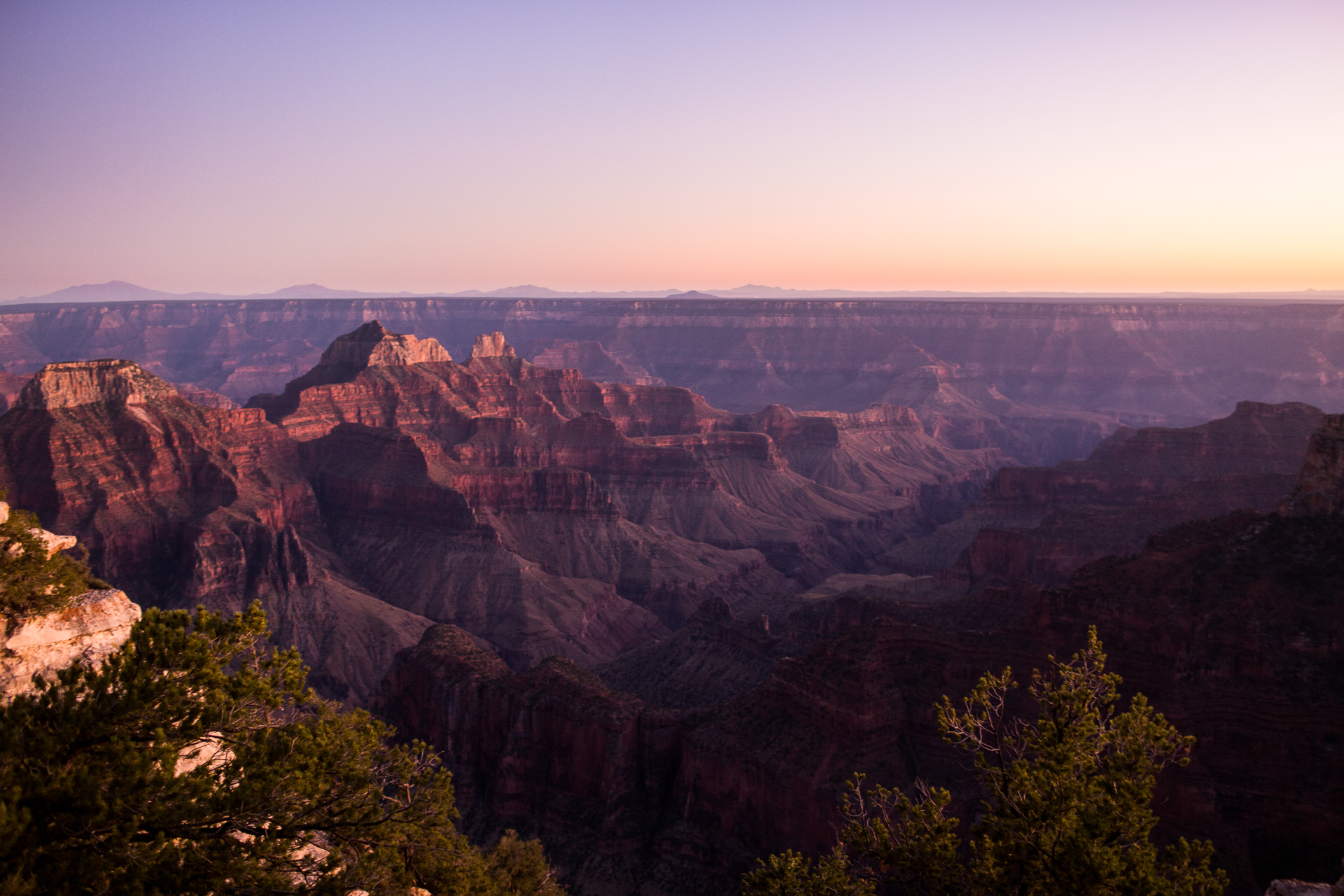
Words cannot capture the Grand Canyon. It will blow your mind, take your breath away, and perform every other idiomatic superlative in existence. At 18 miles wide and 1 mile deep, it just doesn’t make sense. How in the world did was the Grand Canyon created? The answer is simpler than expected: the right kind of sedimentary rock, the mighty Colorado River, and time.
Katie and I want to hike the 24-mile Rim to Rim Trail eventually, but as we couldn’t dedicate 4 days to a car shuffle, we elected to start down the North Kaibab Trail until as far as we could realistically take it. There are signs there that warn you of the hazards of out-and-back canyon hikes: the tougher uphill section comes when it’s hotter in the afternoon (85 Fahrenheit in the canyon on our day), after you’ve expended much of your energy, and after you’ve over-committed to your day by overestimating your capacity.
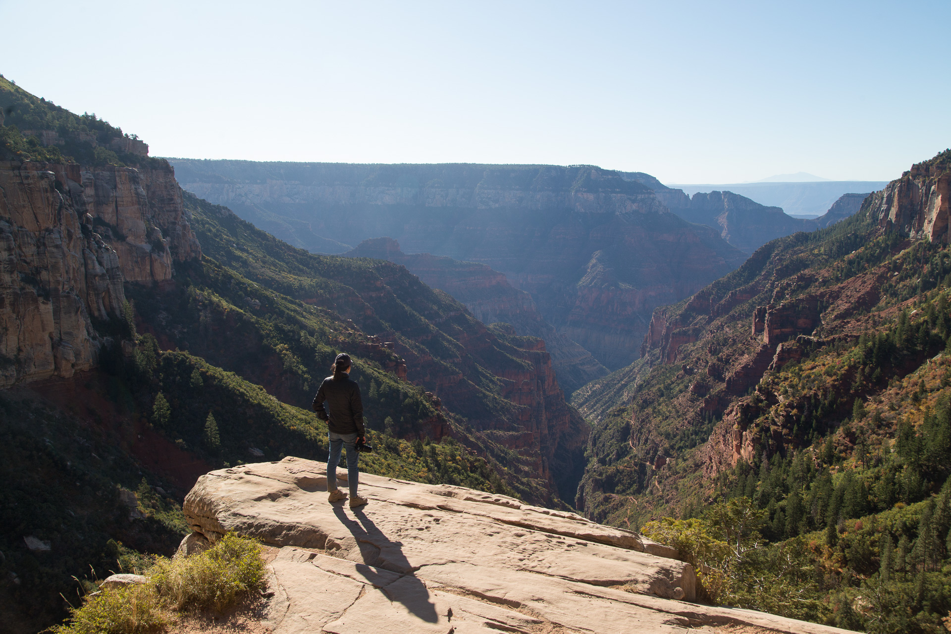
The warnings are warranted. Even though we concluded our hike after only 8 hours or so, we were pooped!
Interlude 1: Page, AZ
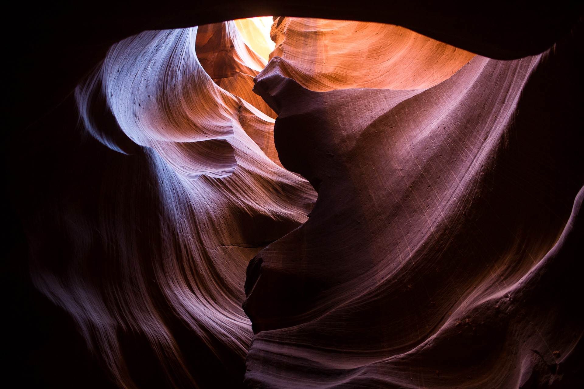
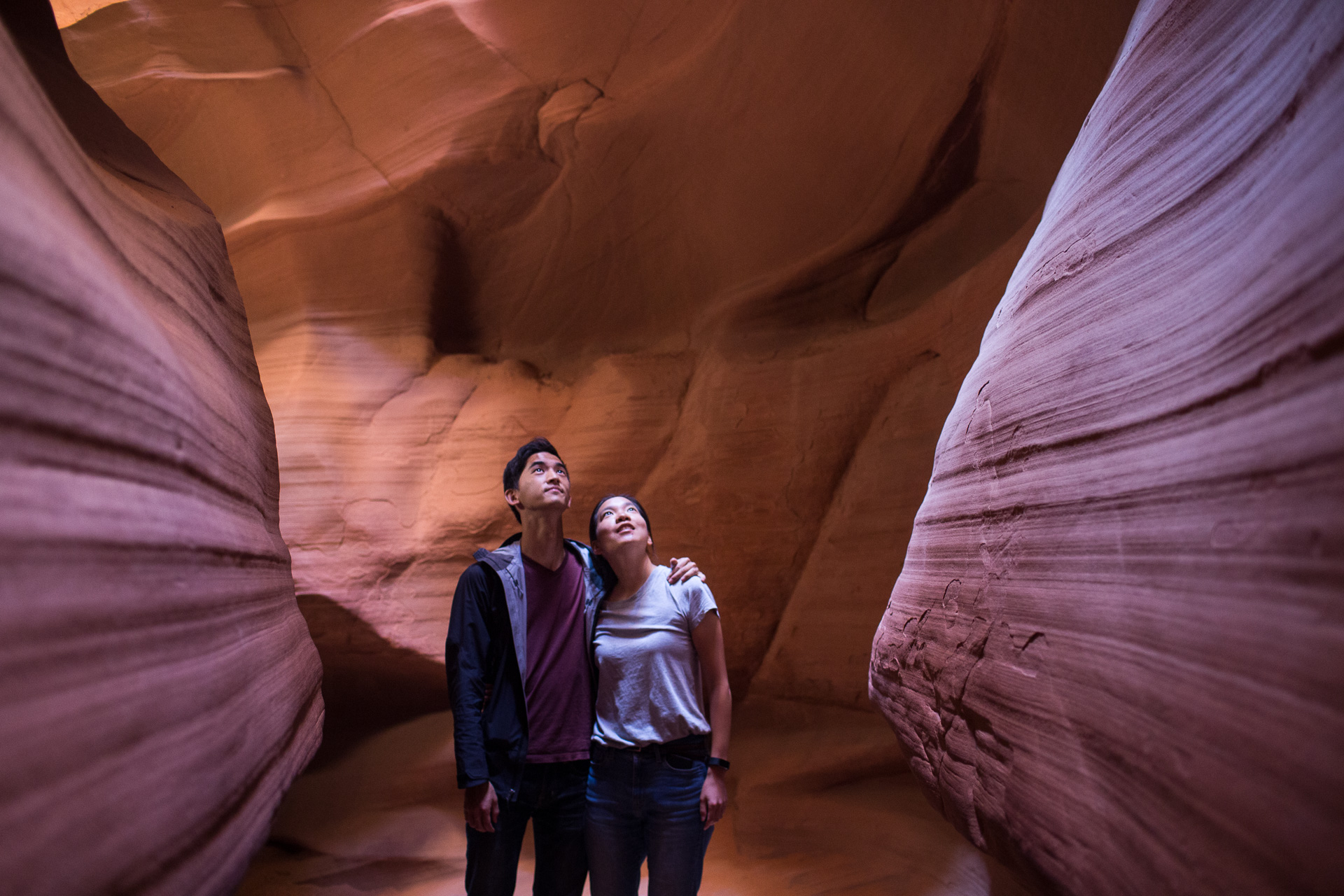
Five days of camping were interrupted by a day back in civilization in Page Arizona, where of course we visited the now legendary slot canyons of Antelope Canyon. It deserves the hype, and it remains the most otherworldly location I’ve ever had the privilege to visit.
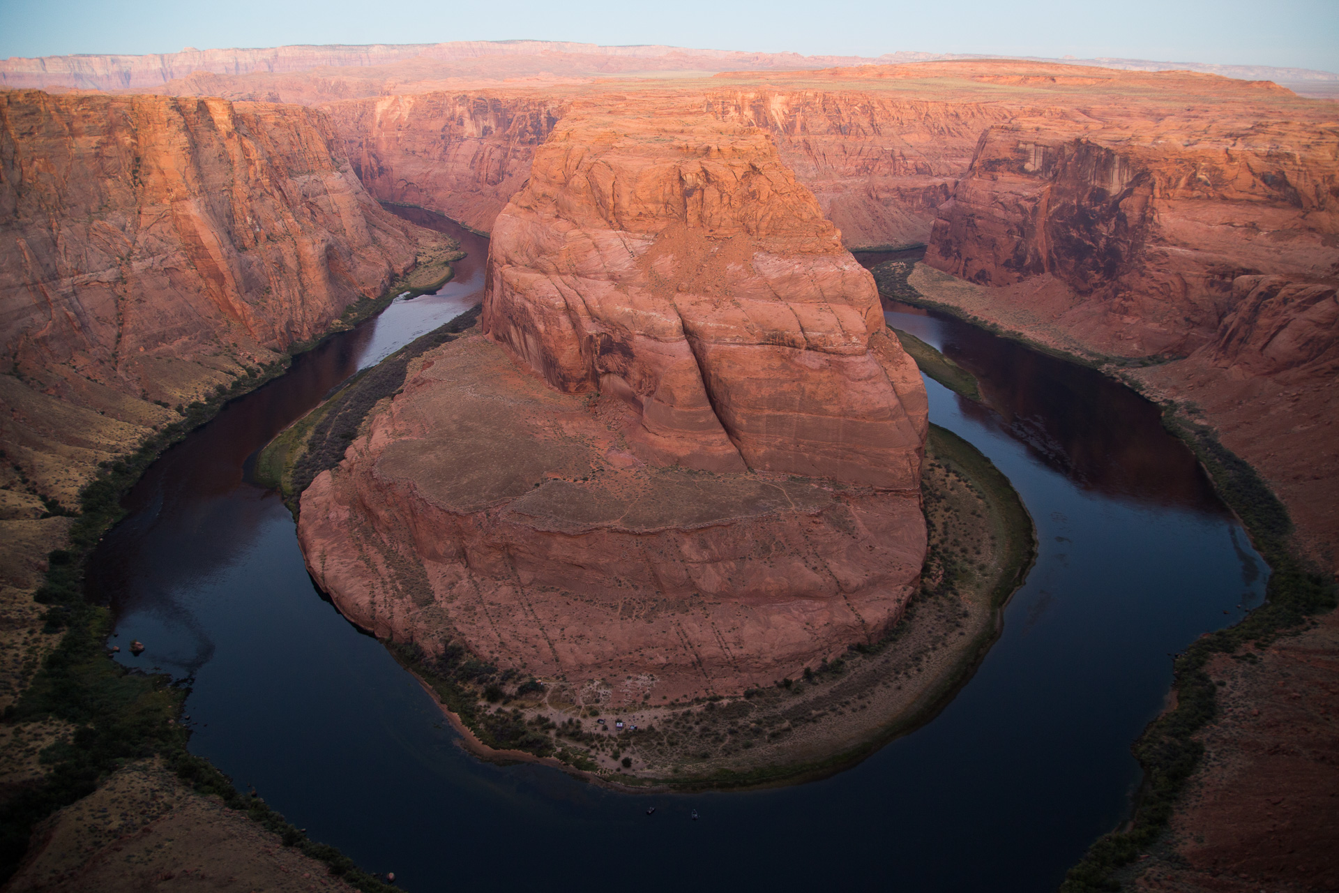
This is accompanied by the equally notorious Horseshoe Bend of the Colorado River. It’s not nearly as interesting as Antelope Canyon, and the city of Page is really cashing in by sneakily charging $10 for parking, but it’s still special. Remember that the Colorado River is not to be outdone and the cliffs here are 1000′ tall.
Chapter 3: Bryce Canyon
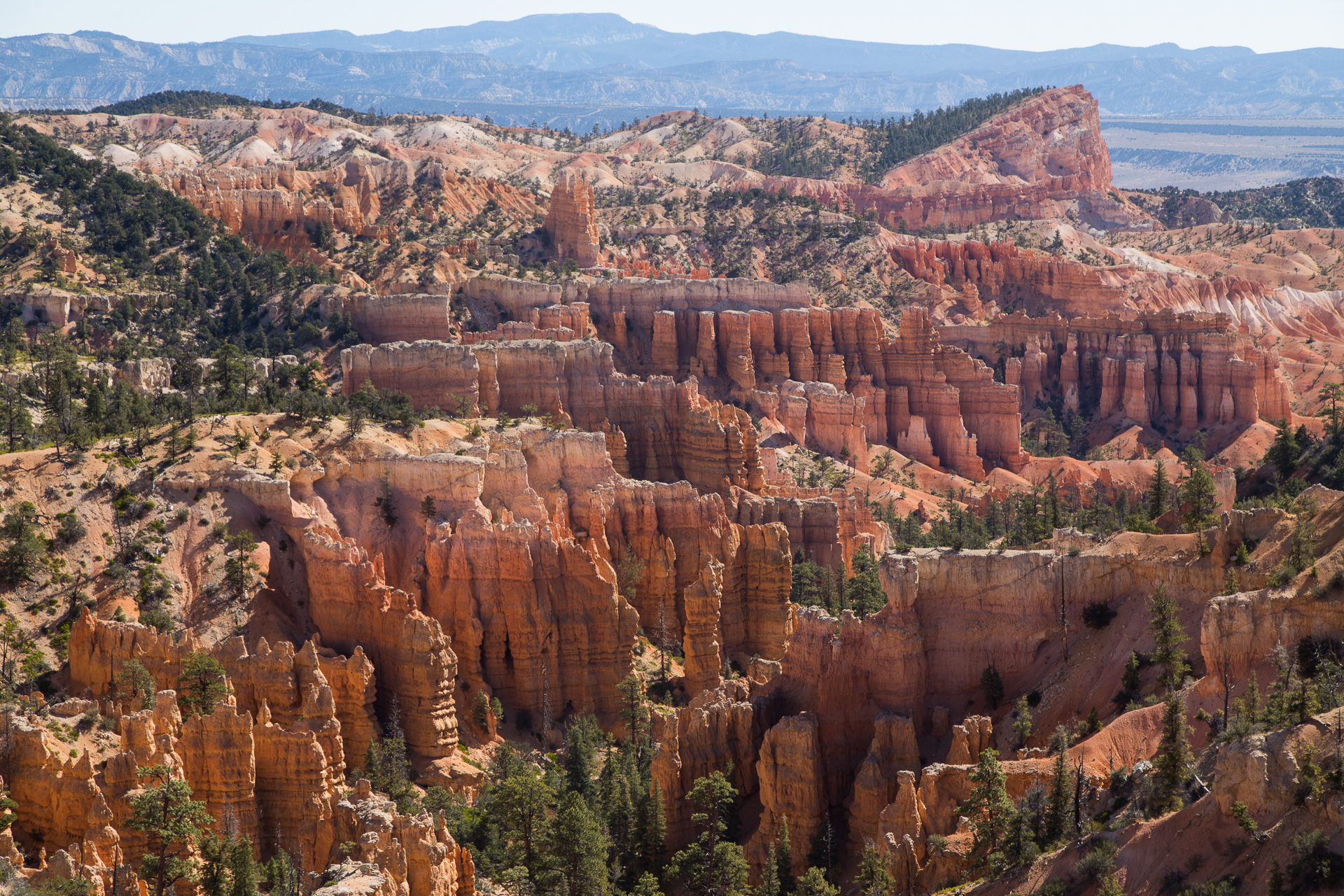
Bryce Canyon is way up there (9000′ at its highest) and way out there. It’s basically a forest except the trees are rocks and the rocks are actually giant pink hoodoos.
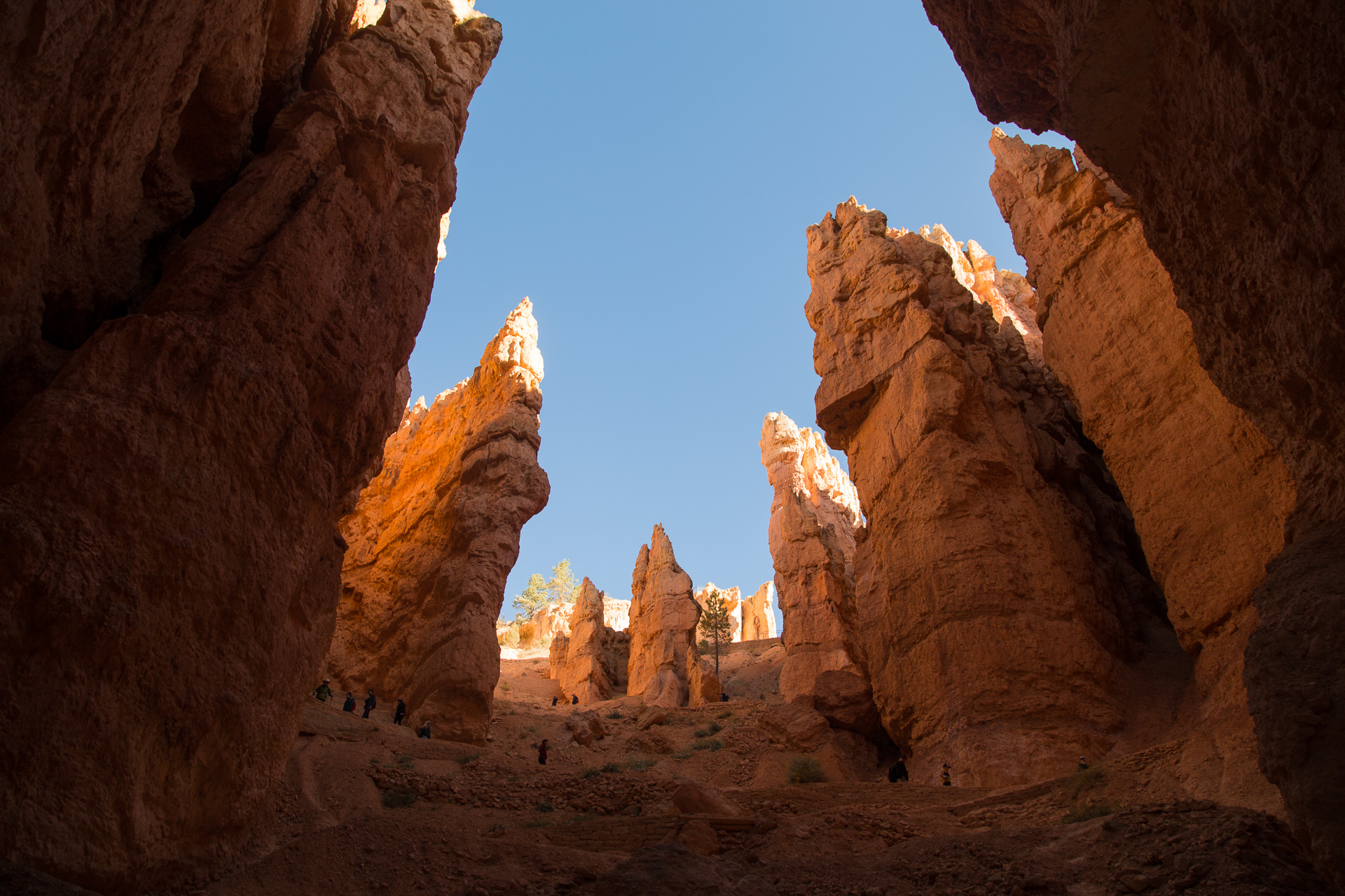
The place is so whimsical, kind of like nature having fun and challenging itself to create as many wacky formations as it could. Bryce Canyon was our favorite National Park for the sheer density of points of interests and the continuously engaging hikes it offers.
The Fairyland Canyon is adjacent to the main Bryce Canyon amphitheater and despite being smaller and having fewer and smaller formations, it feels even more fantastical. Our favorite was a cluster of tall and fine hoodoos that looks like it may have inspired the Disney castle.
Interlude 2: Grand Staircase-Escalante
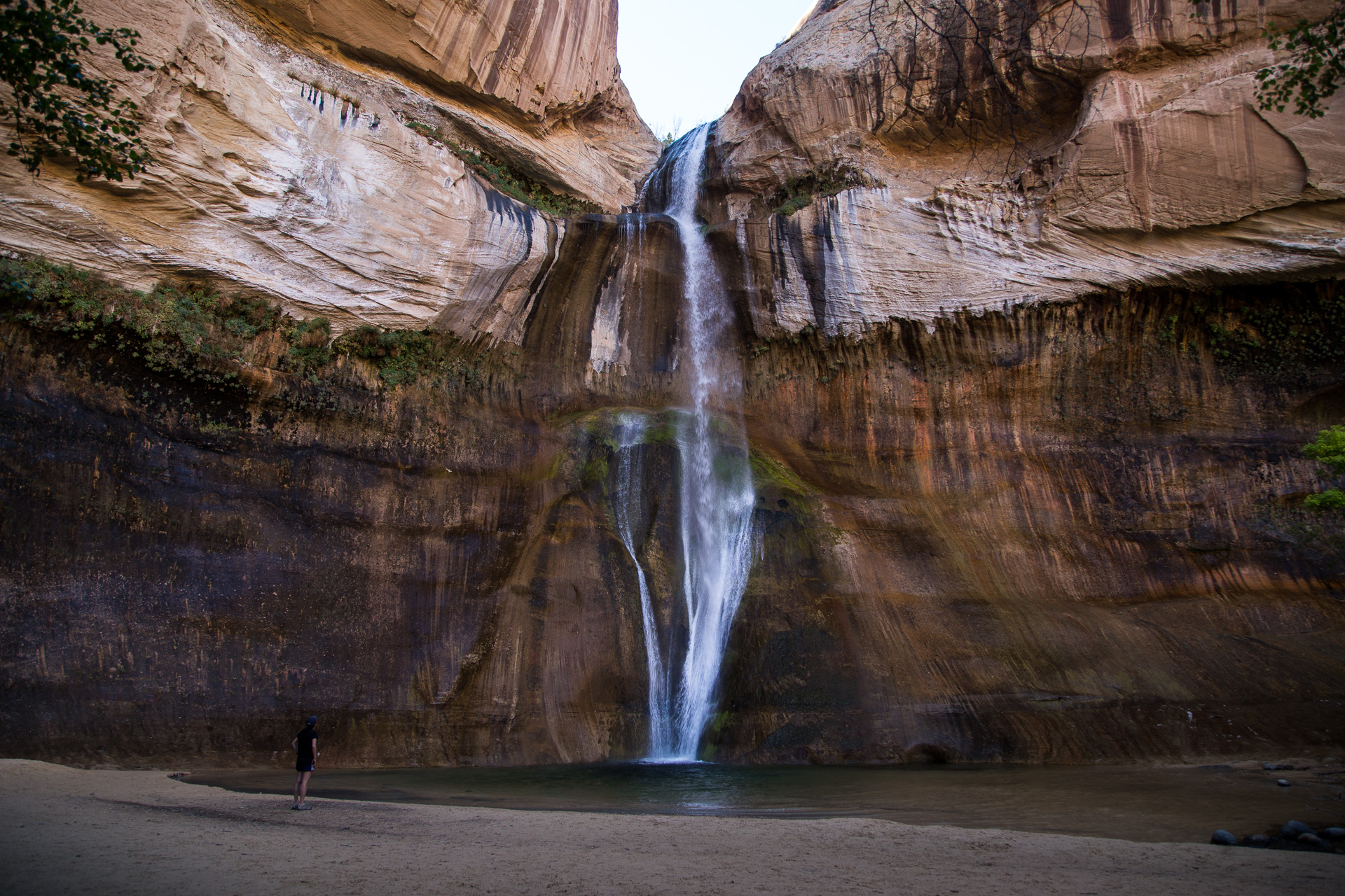
We had planned to spend a day exploring the truly gigantic Grand Staircase National Monument, but being in a diminutive (but fuel-efficient!) rental car precluded reaching most of the interesting landmarks. Thus, this section of the trip was truncated. We did camp near the tallest perennial waterfall in all of Utah, cascading down 120′.
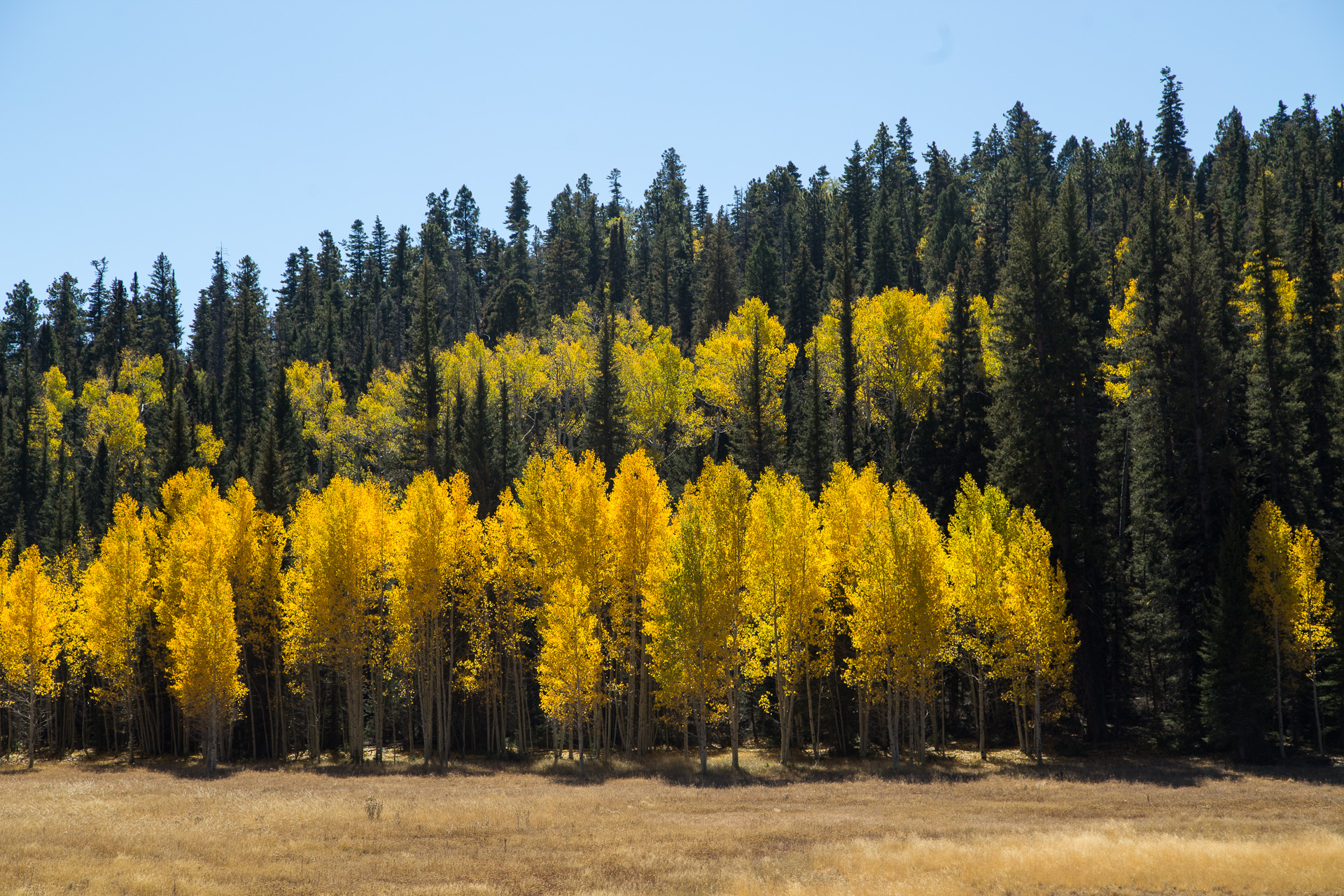
It’s worth mentioning that because we visited in early October, the fall colors were really blooming in the mountains. Most of the vibrance comes in the form of the excellently-named quaking aspens, which were a lovely gold while we did our drive.
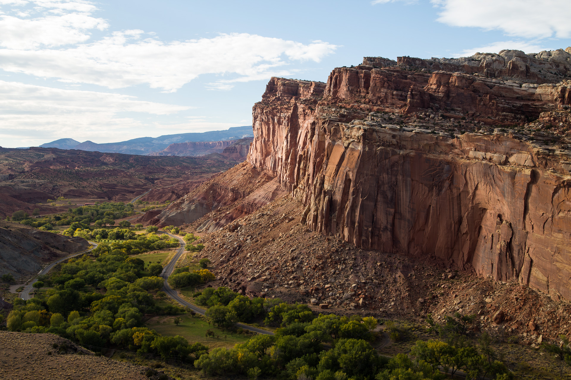
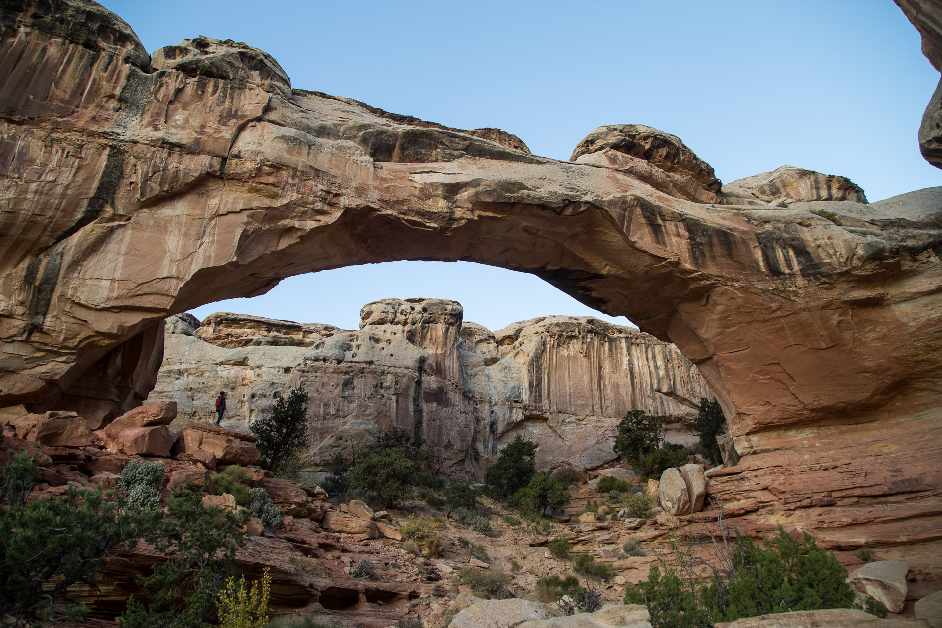
Chapter 4: Capitol Reef
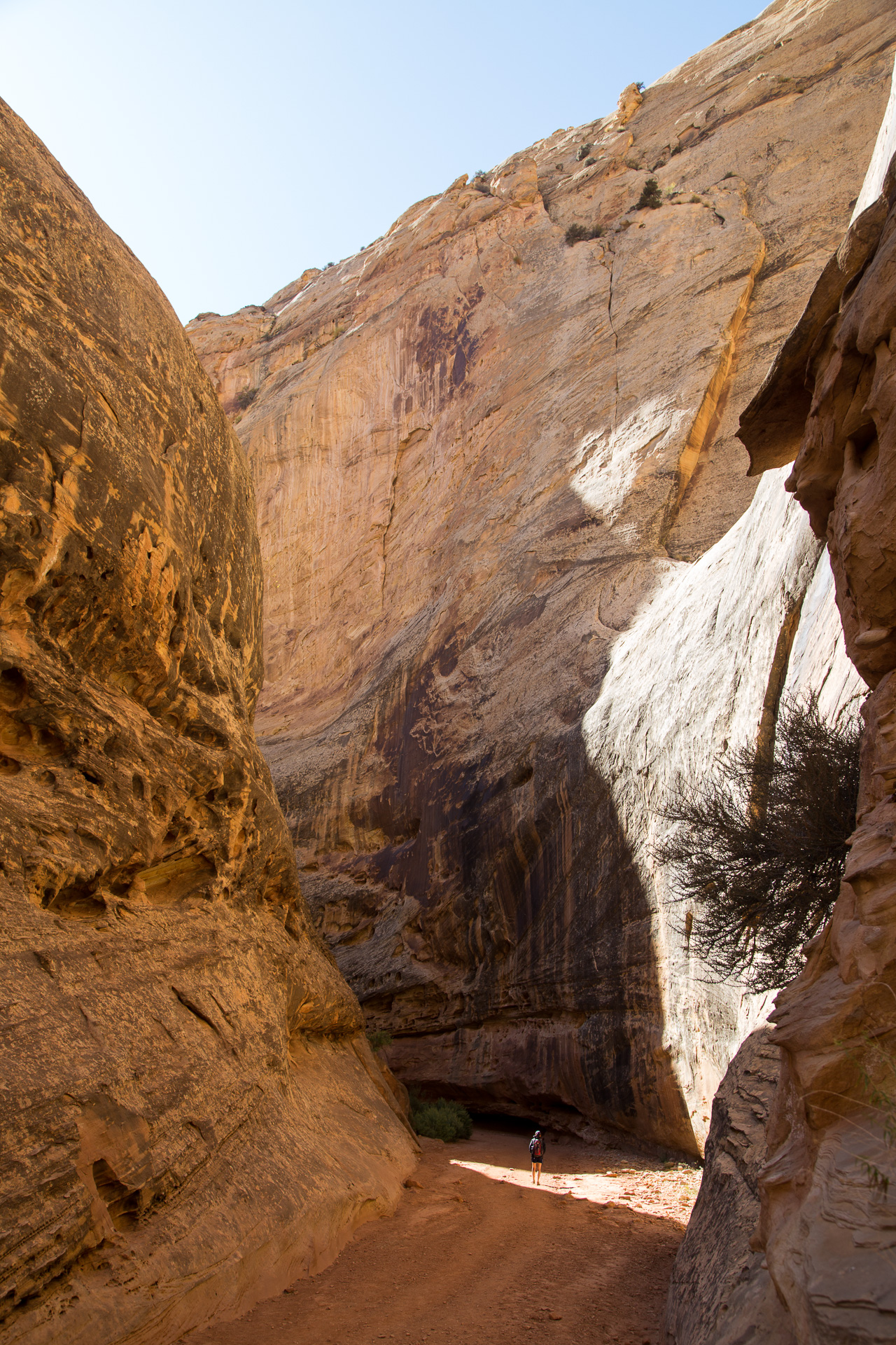
The least visited of the “Big 5” of southern Utah, Capitol Reef national park is an interesting mix of natural formations. For instance, the Grand Wash is a canyon carved through the main rock formations in the center of the park. 10′ wide and 500′ tall in some sections, the canyon has walls that swallow hikers whole.
Meanwhile, there’s also a verdant historic orchard named Fruita right in the middle of it all. There’s a general store that sells thousands of pies per year, horseback riding, and exhibits about the family that used to live there.
If you’ve ever tried to take landscape photos out in the wild, you know that everything depends on the lighting present at the time of day you’re there. That means we frequently scheduled hikes to catch landmarks at sunset or, as was the case for Hickman Bridge, right before sunrise.
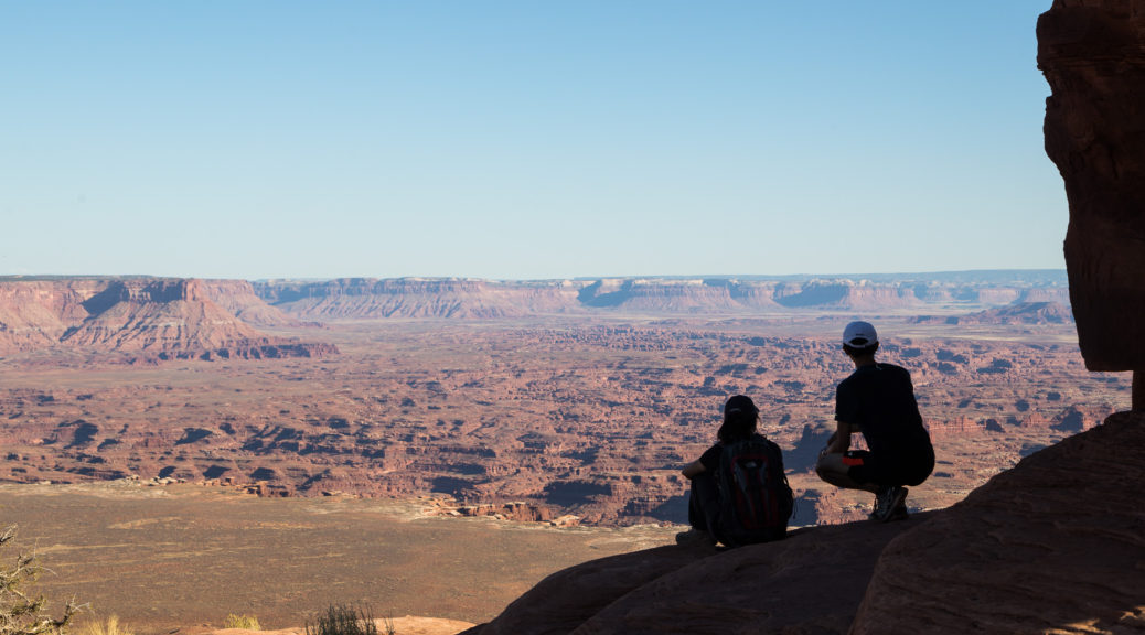
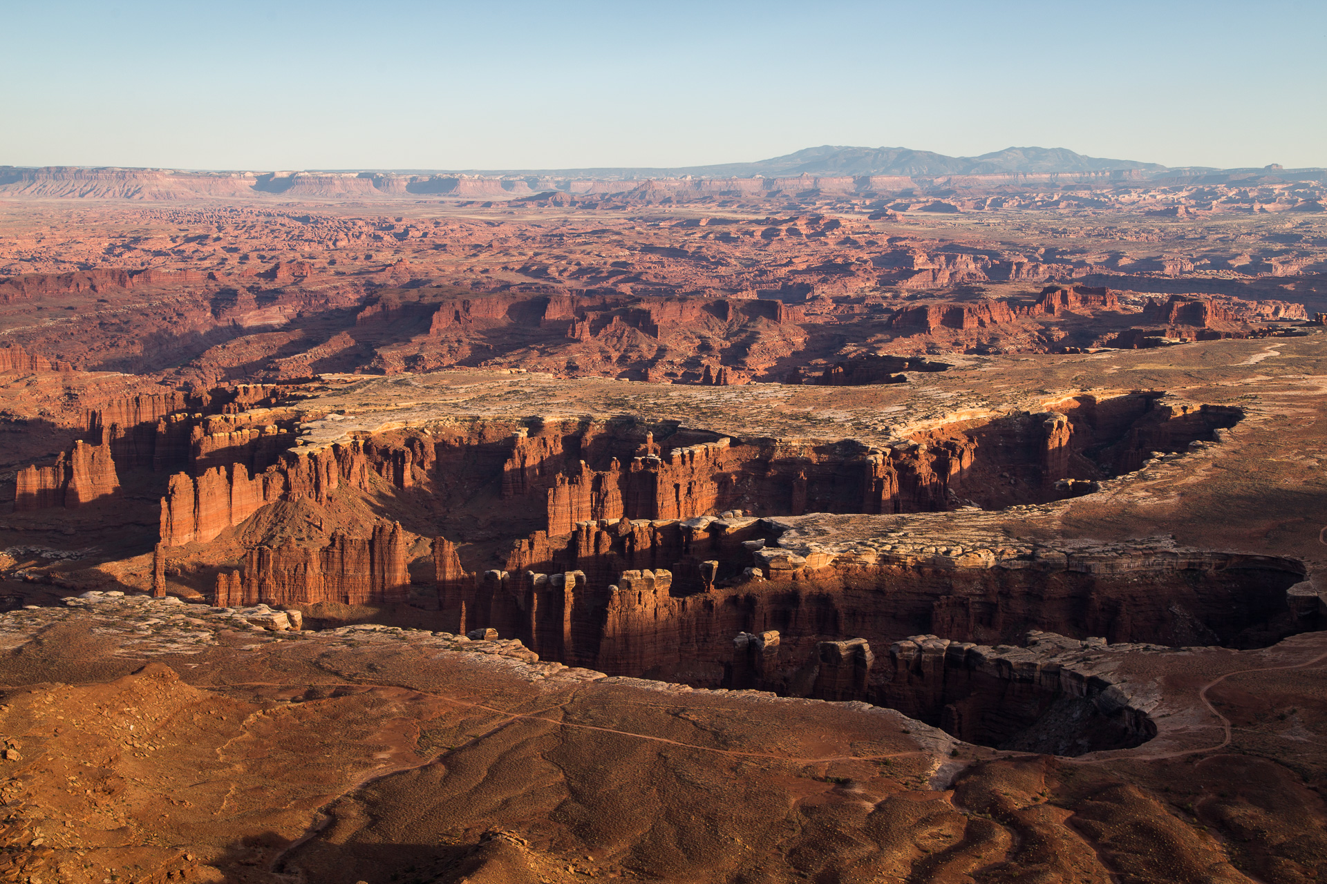
Chapter 5: Canyonlands
The mighty Colorado River returns again, this time paired with one of its tributaries the Green River. Surrounding the confluence lies the three sections of Canyonlands: Island in the Sky to the north, The Needles to the southeast, and The Maze to the southwest.
Once again, the scale of the formations is almost unimaginable. The Island in the Sky rests on a plateau 1200′ above the canyon below, which actually is another a “white stone” plateau about 500′ above another canyon, but actually the Colorado River flows yet another 500′ below that. Layers, I say.
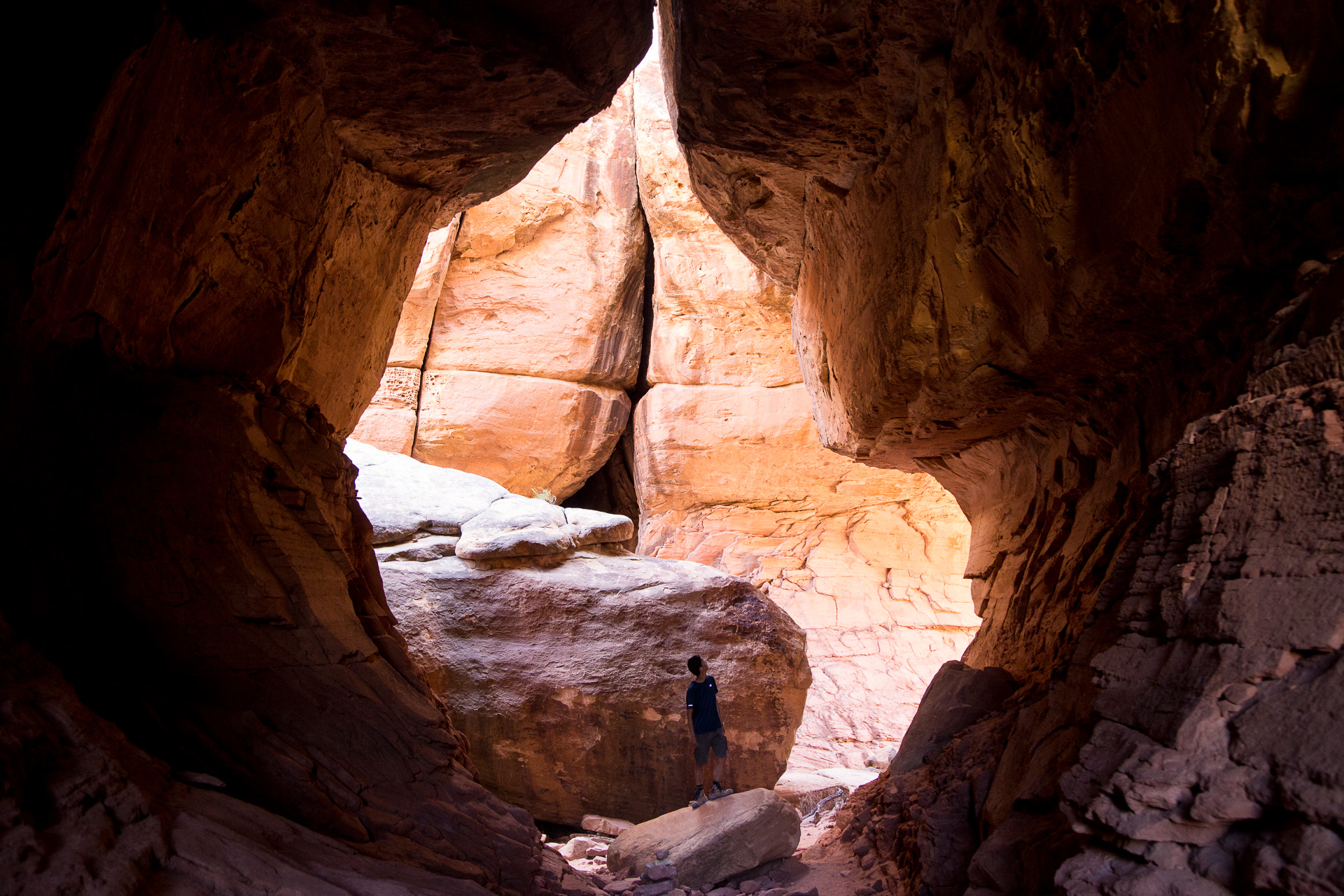
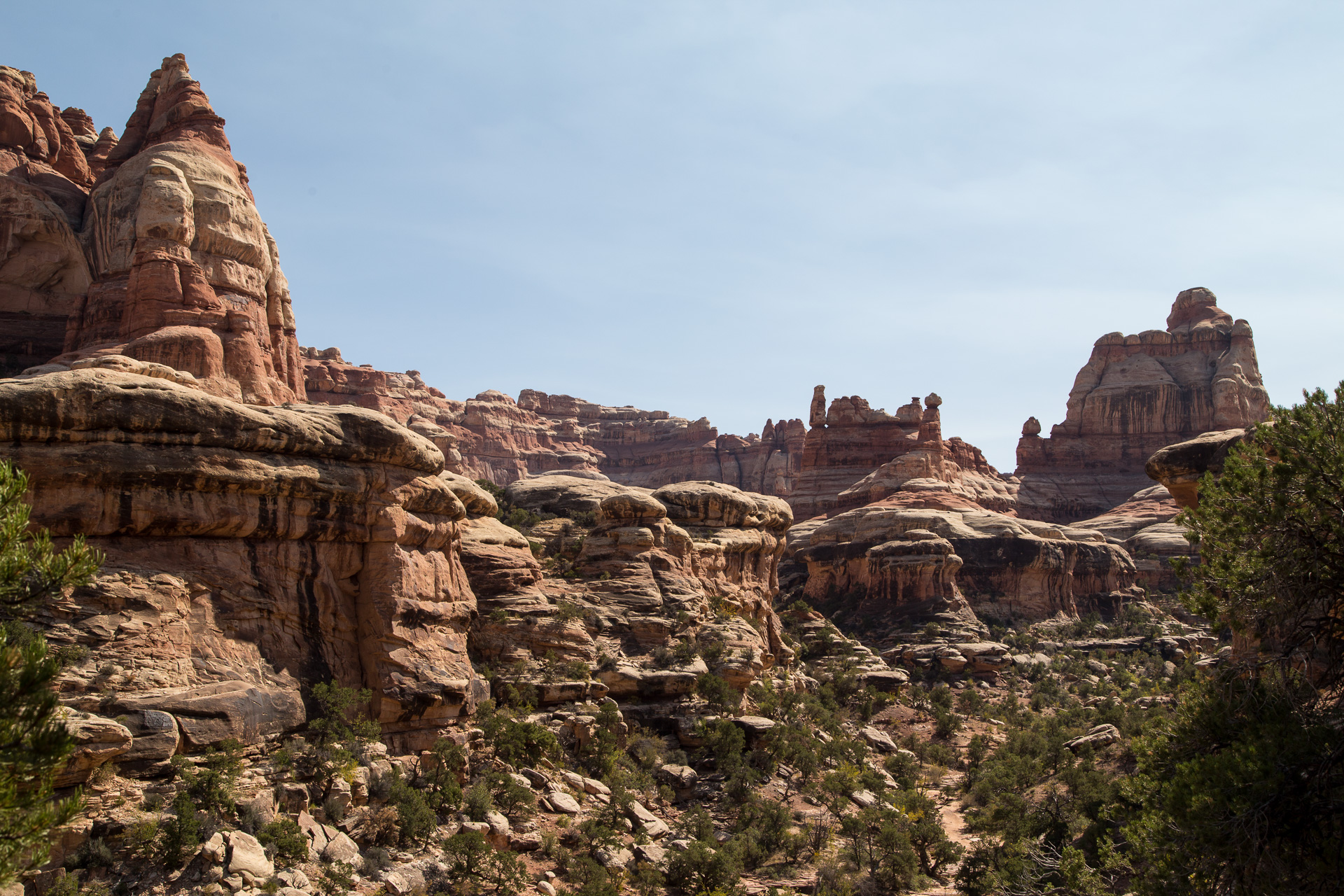
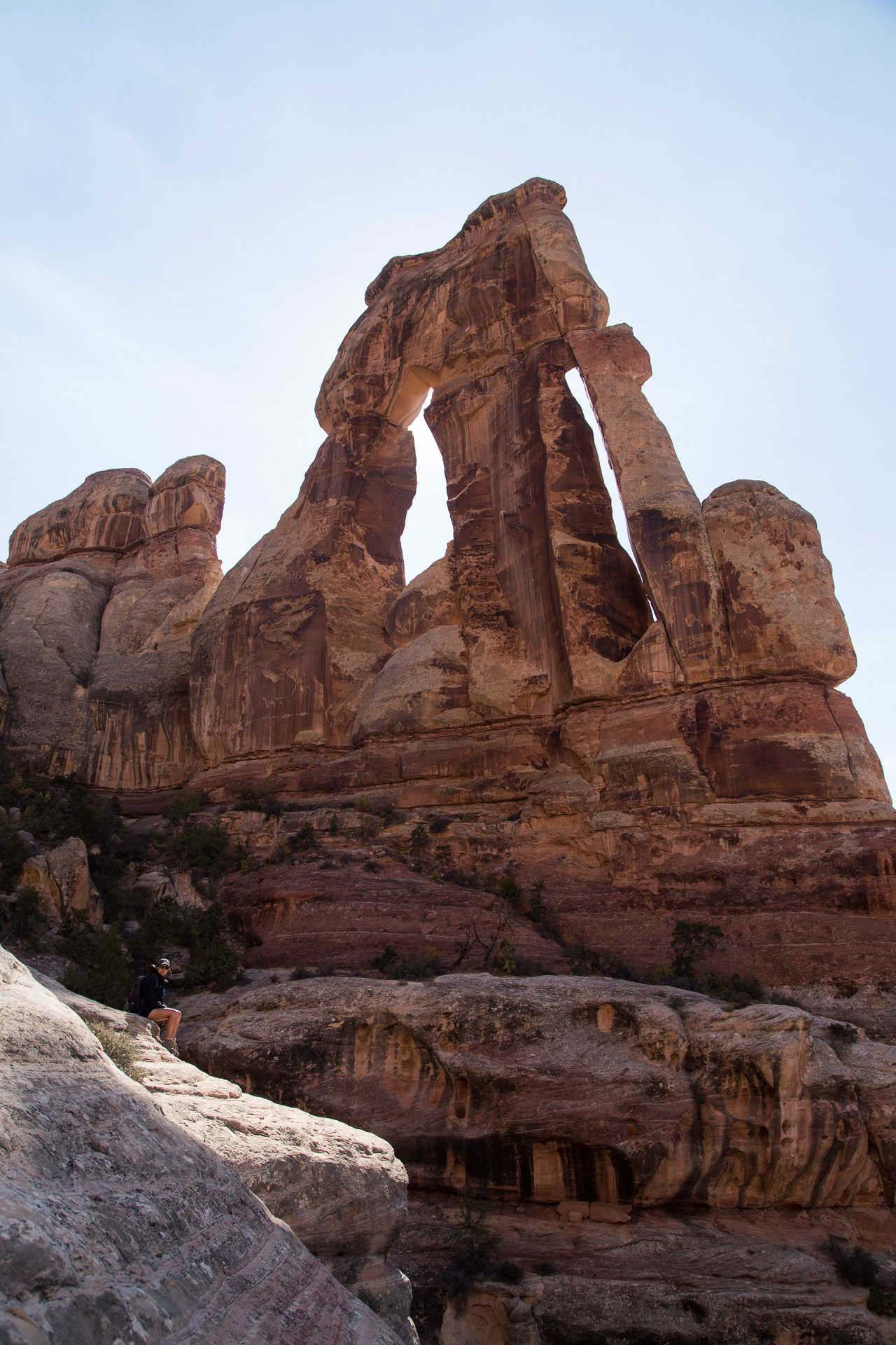
However, our favorite hike was the 15 miles of wandering we did inside The Needles district of the park. It takes an extra two hours driving from the nearby city of Moab, but it’s totally worth it. The formations are strange and varied. They included the Joint Trail following a long cracked seam through a giant rock formation, 2′ wide and 50′ tall in most places; the vertically striped Chesler Park with the namesake Needles formations which looked like giant candy canes in some places and Naboo Palaces straight outta Star Wars in other places; and the enormous Druid Arch at the end of a long hike which may have involved climbing some ladders.
Chapter 6: Arches
Finally, the most accessible of the Big 5 parks: Arches! Surprise surprise, there were plenty of arches to be found.
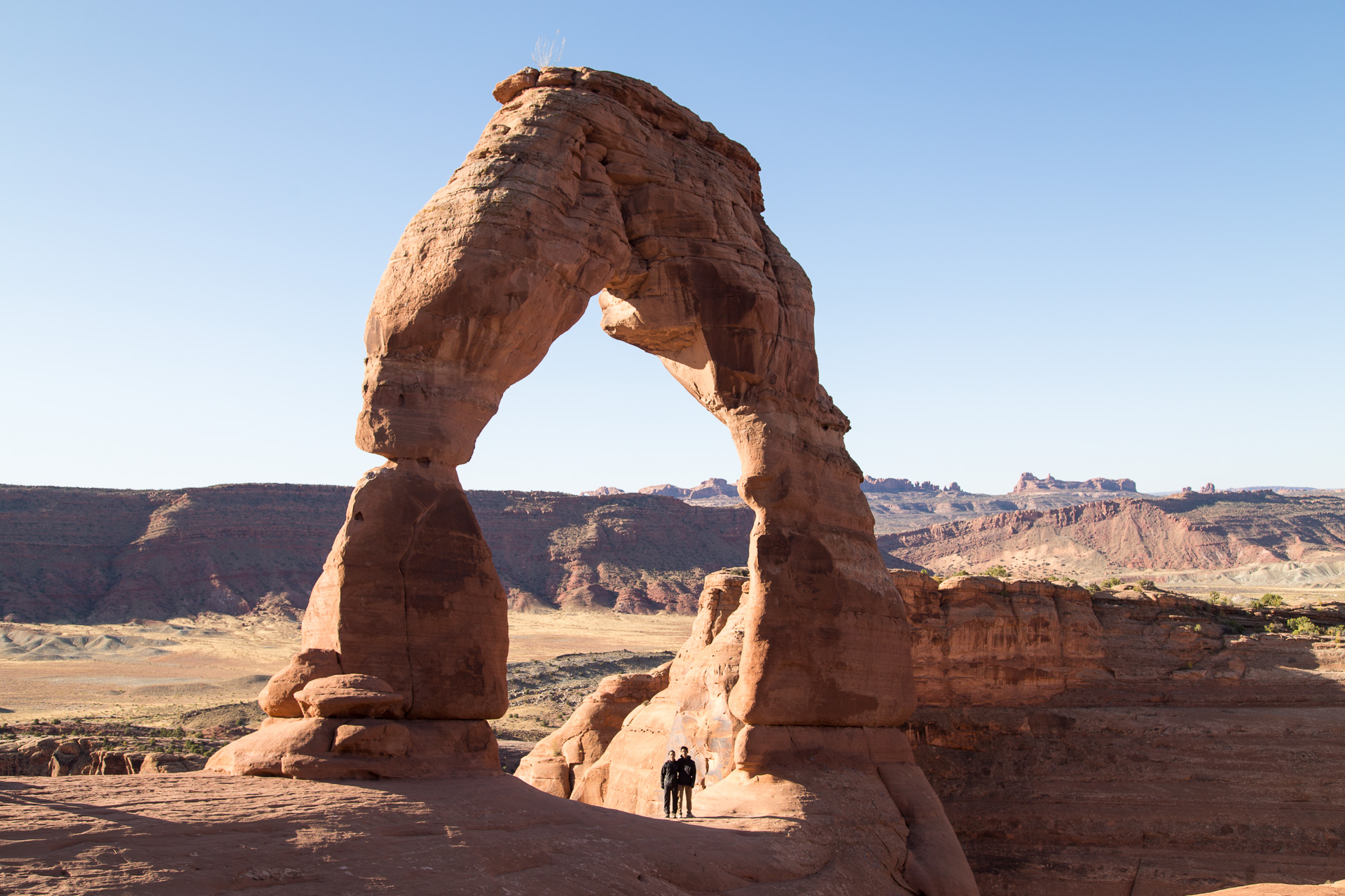
None can beat the iconic free-standing Delicate Arch, perched atop the side of a cliffside bowl, nothing on its scale remotely close to it. I feel so lucky that we exist here during this narrow geological window when erosion has exposed this beautiful formation but yet has not eroded it enough to reclaim it. In the meanwhile, Utah can make it the state license plate.
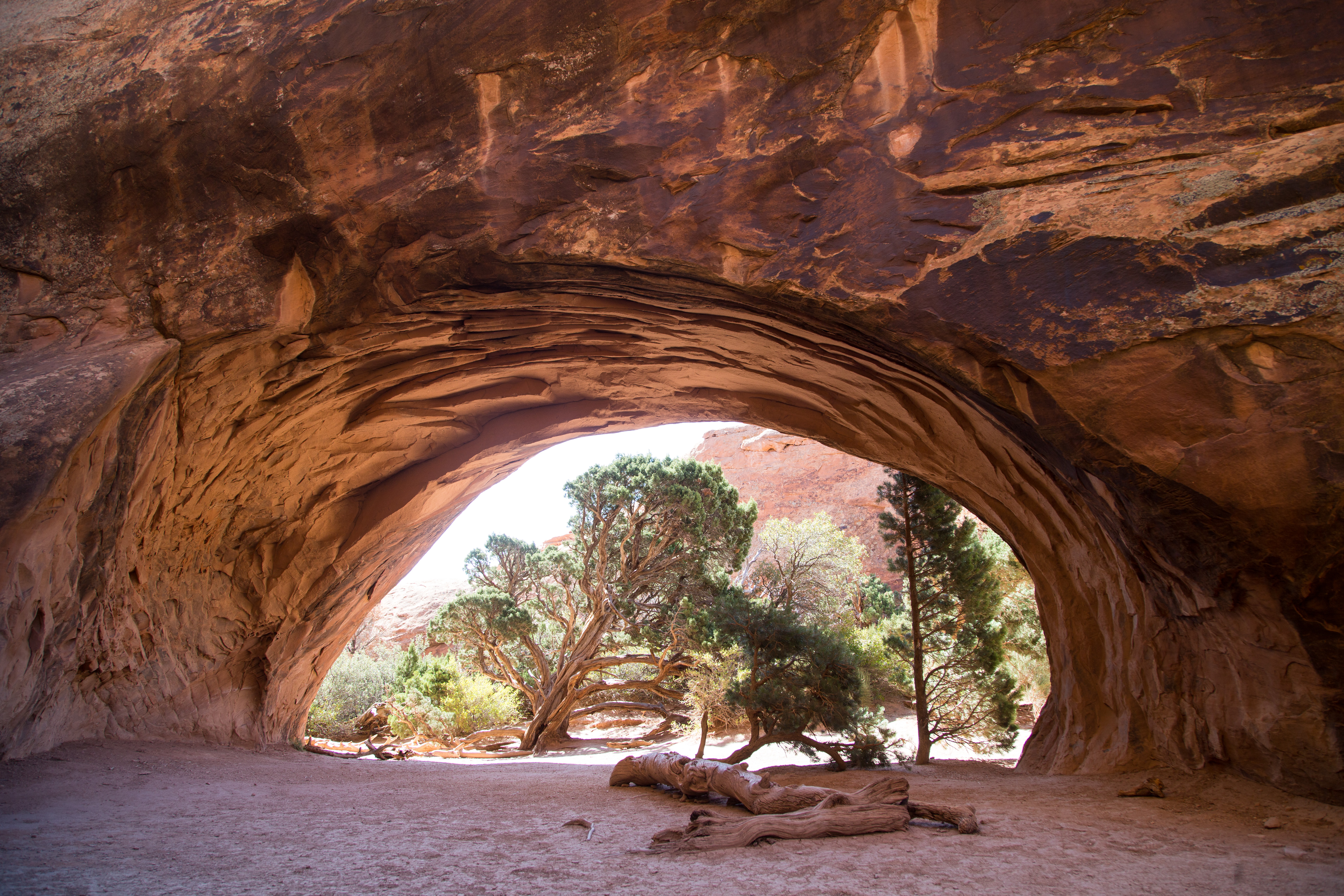
The last hike was the Devil’s Playground, which featured a tour of many more arches of all shapes an sizes. There’s the impossibly thin Landscape Arch (not pictured here), the stacked Double-O arch, the scenic Panoramic Arch, and the “prone to arch formation” Navajo sandstone fins that are the geological basis of the entire park. Maybe in several million years, future generations of humans (or aliens, for that matter) will be visiting a whole new collection of natural wonders…
Epilogue: Drive to Salt Lake City
Moab is the tourist-friendly city adjacent to Arches and close to Canyonlands, but it’s still far from large airports. We saved one last day to drive to Salt Lake City 5 hours away to conclude our trip (and hang out with my old classmate!).
The American Southwest is beautiful. Southern Utah and Northern Arizona surely contain the densest collection of geological wonders of its kind anywhere in the world. Sedimentation, uprising, and erosion are a potent combination, and there were canyons, cliffs, hoodoos, and arches of brilliant colors and creative shapes, all on a scale that’s impossible to capture in words or photographs. If you haven’t gone, go.
I’m planning to design and print another photo book, similar to what I did with my trip to Iceland, but that’s time-consuming and residency is really busy…
Itinerary summary:
Edit 11/21. (Google Maps, Part 1, Part 2). When planning, note that North Rim is closed in the winter and South Rim is a 4-hour drive away.
- EWR->LAS early morning flight. Rent car, get groceries, Hoover Dam, Valley of Fire, drive into Zion [~5 hrs total]. Camp in Zion, which requires reservation 3 weeks prior.
- Zion: Angel’s Landing (5 mi), the Narrows out and back (1-5 mi), Observation Point (2 mi). Camp in Zion.
- Zion: Echo Canyon to Observation Point (~10 mi) since Weeping Rock is closed. Camp in Zion.
- Sunrise in Zion. Drive to North Rim [3+ hrs]. Scenic drive [1 hr one-way in the park]. Camp in DeMotte campground, 20 miles away from canyon.
- North Rim: North Kaibab Trail (~14 mi). Bright Angel Point. Camp in DeMotte.
- Sunrise at North Rim. Widforss Trail (10 mi). Drive to Page AZ [epic 2.5 hrs] for restocking and Hotel.
- Sunrise at Horseshoe Bend. Antelope Canyon ($75-100/person reservation required, as it’s on Navajo Land). Drive to hotel in Panguitch, UT, 30 min from Bryce, which is very high and cold, precluding camping.
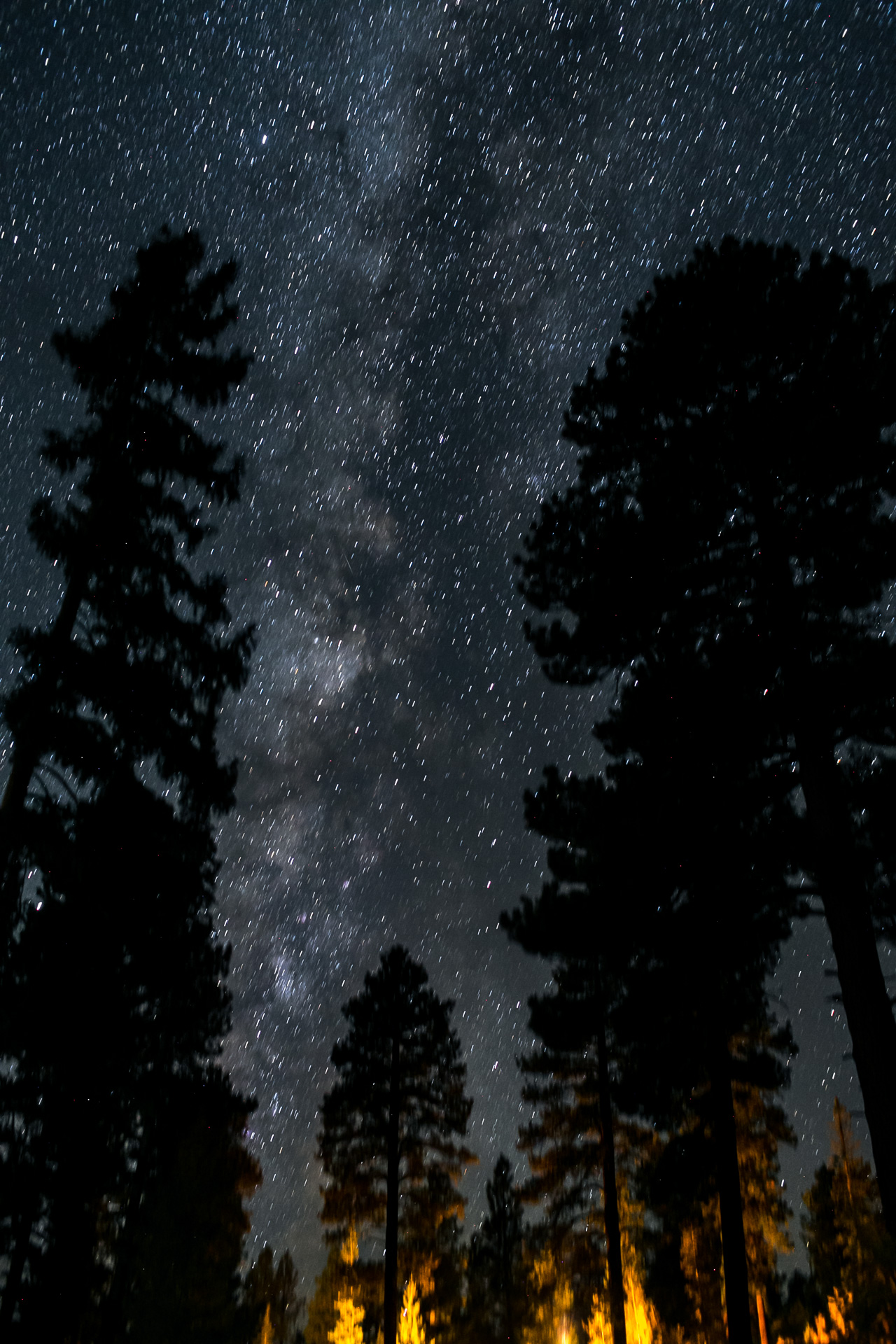
- Bryce: Figure-8 loop (6.5 mi). Scenic drive. Star night shots in Bryce. Panguitch UT Hotel.
- Bryce: Fairyland Loop (8 mi). Random excursions along Scenic Byway 12. Drive to Calf Creek Campground in Boulder, UT, though many other campgrounds around.
- Fail to explore Escalante. Drive to Capitol Reef. Grand Wash (2-3 mi), Cohab Canyon, Cassidy Arch (3-4 mi). Camp nearby.
- Capitol Reef: sunrise at Hickman Bridge (2 mi). Drive to Canyonlands‘ Island in the Sky. Driving tour and many small hikes. Camp in Horsethief Campground, 30 minutes away.
- Drive to Canyonlands‘ Needles [2.5 hrs…]. Hike Chesler Park, Joint Trail, Druid Arch (15 mi). Drive to hotel in Moab, UT [2 hrs].
- Arches: Windows at sunrise. Delicate Arch (3 mi), Devil’s Playground (7 mi). Driving tour. Hotel in Moab.
- Arches: hang out. Drive to Salt Lake City [5 hrs] to hang out with classmate.
- SLC->JFK late morning flight.